


Get digital access to this title and hundreds more with a Kids Discover Online subscription.
Get digital access to this title and hundreds more with a Kids Discover Online subscription.
Regions of North America
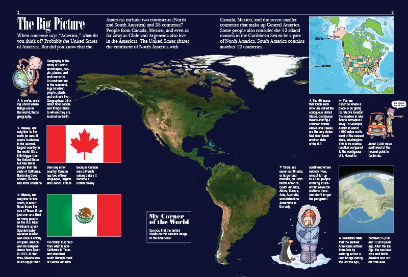
Any given place can be described in an infinite number of ways. Ready to find out what some of those ways might be? For kids studying geography, Kids Discover Regions of North America paints a deeply layered portrait of North America and enables them to easily see the connections among the different characteristics of any particular location. First, kids get an overview of the regions including a focus on the countries that occupy both North America and South America. Then they embark on a journey across North America, stopping to examine key landforms, bodies of water, climate, and vegetation in the different regions. Kids especially interested in their own region can find plenty of compelling images and details.
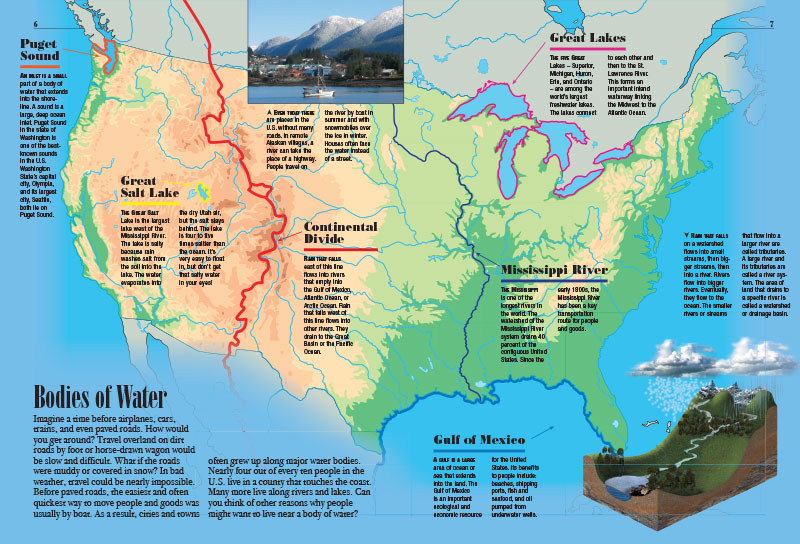
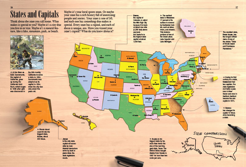
Visually oriented kids can have fun reading and comparing the many colorful maps of the United States showing climate, vegetation, and other geographic data. Kids who want more details about particular features, like the Continental Divide, the Rocky Mountains, and the desert in the Southwest, can enjoy the informative captions that accompany each map. Kids interested in how people fit into the picture will find more than enough details to satisfy their curiosity, not to mention wow-facts about states and capitals, like Rhode Island being the smallest state with the longest official name.